Launch Map Viewer
Launching map...


Design for Conservation

Design for Conservation: News 2017


Environmental Metrics and Valuing Nature in Hong Kong

Today, HKU Masters students presented their explorations of environmental metrics and contested development sites across Hong Kong for the research seminar course "Design Analytics: Nature, regions, and the erosion of conservation in Hong Kong". Many thanks to Deborah Kuh, Head of the Hong Kong Development Bureau's Greening Landscape and Tree Management Section, WildAid's Alex Hofford, and HKU colleagues for engaging with the students during their presentations.

Map including student project locations, Green Belt conversions, and conservation agreement sites. By Ashley Scott Kelly, 2017.
By WONG Hiu Yan Monique, 2017.
By CHAN Howe, 2017.
By CHAN Howe, 2017.

Posted by: (Design for Conservation)

Upstreaming Design for Linear Infrastructure with HKILA

Ashley Scott Kelly will deliver a talk, hosted by the Hong Kong Institute of Landscape Architects (HKILA), titled:

Engineering Conservation:
Upstreaming landscape design and sustainable construction in linear infrastructure planning
.

Date: Tuesday, 24 October 2017,
Time: 7:00-9:00 PM.

Where: Caritas Community & Higher Education Service,
14/F, On Lok Yuen Building, 25-27A Des Voeux Road Central, Hong Kong.

Synopsis:
Regional corridors propelled by China's 2013 Belt and Road Initiative are set to connect Eurasian economic centers through some of the last frontiers of Central, South and Southeast Asia. These frontiers are typically the domain of multilateral development banks and international environmental NGOs. This talk argues that design-level considerations, from site-specific wildlife mitigation strategies to decisions on slope engineering technologies, should drive or at least have a major upfront role in sustainable infrastructure planning. Long isolated by ethnic conflict and their distance from the state, Myanmar's biodiverse border areas harbor some of the largest intact forest habitats left in the Greater Mekong Subregion (GMS). Since 2015, a team from HKU's Division of Landscape Architecture has promoted sustainable development of the cross-border Dawei-Kanchanaburi Road Link, which forms the western end of the GMS's Southern Economic Corridor. Through a series of design-advocacy efforts, including a species-specific road design manual, 3D-printed stakeholder engagement models, and wildlife mitigation informed by predictive wildlife movement modelling, I will showcase potential opportunities for landscape architecture to proactively engage infrastructure development and regional landscape planning. Critical to these efforts are the building of site-specific design scenarios and parametric modelling approaches that overcome the lack of development transparency and poor spatial data often prevalent in developing contexts. Supported by a multidisciplinary team of landscape designers connected to policy experts, biologists and scientists through the World Wide Fund for Nature (WWF), this work offers an urgently needed model of design collaboration. It has been disseminated to national and regional levels of the Myanmar government, the Thai road developer, Myanmar civil society, and agencies across Southeast Asia.

Registration and details: https://goo.gl/vHW8s2

This talk is for HKILA Continuing Professional Development (CPD) credit.
$150 Walk-in; $100 Pre-registration; $50 student members of HKILA/YLAG.

Upstreaming Design for Linear Infrastructure talk with HKILA, 24 October 2017.

Posted by: (Design for Conservation)

Land Development vs Conservation Game with Storefront for Art and Architecture

New York-based Storefront for Art and Architecture, in partnership with Hong Kong Design Trust, held events across Hong Kong from 7-9 July as part of Storefront IS (International Series) Hong Kong. The three-day program included public city walks on urban transformation, dialogues on cross-border issues, and mixed-media performances exploring density, sustainability and development.

At the closing event, Ashley Scott Kelly hosted a game titled "Land Development vs Conservation Hong Kong". The game challenged participants to propose alternative sites for a new housing estate, taking into account an array of statutory regulations, development costs, and ecological characteristics. Teams debated over five maps revealing landscape character, vegetation and species richness, land cover, zoning, land vacancy, and features such as landslide risk and slope maintenance.

The game boards' area covered approximately 4 square-kilometers centered on Tai Wo Ping, one of the Hong Kong Development Bureau's some 190 potential housing sites, many of which are located in Green Belts. This controversial site was raised for judicial review in 2015 because its tendering process included slope maintenance works within a large portion of Lion Rock Country Park.

For scoring, a grid of 50 x 50-meter squares was overlaid on each map, summarizing that map's developmental and environmental costs. The team that selected a development site with the least total cost won. Additionally, teams were given the opportunity to "swap" or trade 0.5 hectares of their chosen site with an area of lower development cost, so long as that new area was exceptional in its environmental or conservation value.

This game uses a scoring system that challenges players to assign value to places based on qualities that aren't easily comparable yet must be considered. While these maps are but a small sampling of all ecological criteria necessary for sustainable development planning, the game sparks dialogue and raises awareness of such criteria, encouraging a wider understanding of development threats and opportunities across the territory. The game does include controversial components, such as reductive environmental valuation and "swapping" or trading of Green Belt areas, however, it is created in the spirit that increased knowledge leads to more rational debate. Lastly, these maps are an approximation of actual information and do not necessarily draw from the sources noted (remember, it's a game!).

Credit for the idea and format of the game is given to Stanford's Natural Capital Project and World Wide Fund for Nature (WWF), who created similar games for protected area planning.

Teams play Land Development vs Conservation Hong Kong, a landscape planning game, at Storefront IS Hong Kong.
Landscape planning game uses one of HK Development Bureau's planned housing development sites.
Game participants consider landscape character, vegetation and species richness, land cover, zoning, land vacancy, and features such as landslide risk and slope maintenance.

Posted by: (Design for Conservation)

Forum on Sustainable Infrastructure with ADB and WWF

The Asian Development Bank (ADB), together with World Wide Fund for Nature (WWF) and Vietnam's Ministry of Natural Resources and Environment, hosted the Forum on Sustainable Infrastructure: Integrating Climate Resilience and Natural Capital into Transport Infrastructure Planning and Design on May 17 and 18 in Hanoi, Vietnam.

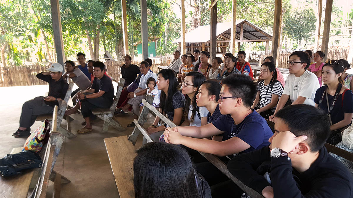
During the forum, Ashley Scott Kelly presented innovative ways that design-level considerations can drive sustainable infrastructure planning. His talk, "Infrastructure, Impact and Uncertainty: Scenario-based approaches to upstream design, wildlife connectivity and sustainable construction in transport planning for southern Myanmar", included work on the Dawei Road Link with Dorothy Tang at HKU, WWF, and Smithsonian.

The event convened planners, engineers and climate specialists alongside government ministries, multilateral banks, bilateral aid agencies, infrastructure finance investment firms, NGOs and academia. The forum was divided into five sessions, covering: 1) Designing ecologically sensitive transport infrastructure; 2) Building resilient infrastructure working with nature and bioengineering; 3) Facilitating finance for sustainable infrastructure; 4) Improving options with better planning; and 5) Strengthening the enabling environment.

The forum was attended by high-level officials, including a large delegation from Myanmar: Directors General of the Ministries of Construction and Rail Transportation, and Directors and Deputies from the Ministry of Natural Resources and Environmental Conservation, Highways, Investment, and Transport and Communications. Government ministries also joined from China, India, Sri Lanka, Nepal, Bhutan, Mongolia, Thailand, Cambodia, Lao, and Vietnam. Experts attended from institutions and organizations from across Asia, Europe, Australia, and the Americas.

http://www.gms-eoc.org/events/forum-on-sustainable-infrastructure-

Forum on Sustainable Infrastructure: Integrating Climate Resilience and Natural Capital into Transport Infrastructure Planning and Design.

Posted by: (Design for Conservation)

Design on the Road to Burma, Final Review

Final-year HKU undergraduates in landscape architecture defended their design strategies today for southern Myanmar. Many of their designs built credible scenarios of how changes in landscape management and planning and design scopes can mitigate development and conservation conflicts, especially in areas of weak governance and environmental regulation.

View course page.

Final review for Design on the Road to Burma 2017.
Minnie CHU Lok Yan presenting project From Ethnic to Wildlife Conflict: Ecological corridors and refugee repatriation on the upper Tanintharyi River.
Critics debate the possible futures of the Dawei Special Economic Zone.
Daisy LAU Tik Sze presents her project on alternative economies for community forestry and the defunding of Tanintharyi Nature Reserve Project.
Natalie KHOO Ting Fung defends her project Programming the Forest: Non-zoned approaches to customary rights in Tanintharyi Nature Reserve.

Posted by: (Design for Conservation)

HKU Students Return to Southern Myanmar

For the third year, final-term undergraduate students from the University of Hong Kong, led by Ashley Scott Kelly and assisted by Maxime Decaudin, travelled overland from Thailand to Myanmar to study regional development and conservation impacts in Myanmar's Tanintharyi Region. Preceding the trip, the students spent 6 weeks producing a 120-page research report that combined detailed timelines on investment and conservation, regional case studies, and site-specific studies on landscape processes from mining extraction to wildlife movement. During their travel, the students visited large industrial estates along Thailand's Eastern Seaboard, including Map Ta Phut and Laem Chabang, Dawei's resettlement housing and community forest programmes, met with several Myanmar civil society organizations and international environmental NGOs, and participated in a village-led conservation ceremony.

The students, Maxime, and Ashley extend their thanks to the people of Michaunglaung, the people of Kamoethway, Rays of Kamoethway Indigenous People and Nature, Dawei Development Association, Spirit in Education Movement, forestry officials at the Tanintharyi Nature Reserve Project, Wildlife Conservation Society, and the World Wide Fund for Nature.

View photos from the field.

Site visit along Dawei Road Link at Elephant Cry Hill, Tanintharyi, Myanmar. By Ashley Scott Kelly, 2017.
Map Ta Phut Industrial Estate on Thailand's Eastern Seaboard. By Ashley Scott Kelly, 2017.
Interfaith ceremony for Fish Conservation Zone, Kamoethway. By Ashley Scott Kelly, 2017.
Students meeting with Michaunglaung village to discuss TNRP Corporate Social Responsibility program. By Maxime Decaudin, 2016.
Dawei SEZ main road. By Ashley Scott Kelly, 2017.

Posted by: (Design for Conservation)

Automated Monitoring of Illegal Wildlife Trade in Hong Kong

Illegal Wildlife Trade in Hong Kong, Automated notification of potential cases in the judiciary

To help efforts limiting or banning the trade in endangered species, Design for Conservation is hosting an automated notification system that searches Hong Kong's daily court listings for potential wildlife crime related offenses.

Hong Kong's Customs and Excise Department reports a recent increase in the market value of illegal wildlife seizures in Hong Kong totalling HK$ 117 million for the five-year period ending October 2015. They further estimate only a 10% seizure success rate.

The Hong Kong Judiciary's Daily Cause Lists "provide[s] members of the public with information on the schedule of court hearings and related matters" by 18:30 the day preceding these cases. As the listings are difficult to browse, users of this automated monitoring system will be informed via email roughly around the same time with specific cases involving species from CITES Appendix I, II and III, violations of the Protection of Endangered Species of Animals and Plants Ordinance, and even potentially related cases involving unmanifested cargo.

To sign up for notifications, please send a request to ashley@designforconservation.org

Visualized below are Hong Kong's 2015 imports of endangered Species. Appendix I species, such as elephant, rhino, and tiger, are shown in Red, while Appendix II and III trades are shown in gray.

Hong Kong Trade in Endangered Species 2015.

As an aside, this map is drawn in the Cahill-Keyes map projection, which displays country areas and shapes more accurately than common web mapping systems. Additionally, older maps showing global trade and financing of environmental programs are included here for comparison:

  • 1) 2010 China Tropical Timber Trade in Rough and Sawn Wood, shown in Lambert Azimuthal Equal Area;
  • 2) Comparison of global NGO biodivesity regions, shown in Waterman; and
  • 3) 2012 Global Distribution of REDD+ (Reduced Emissions from Deforestation and Forest Degradation Programs), shown in Fuller's Dymaxion projection.
2010 China Tropical Timber Trade in Rough and Sawn Wood.
Global Biodiversity Regions, as declared by Conservation International, World Wide Fund for Nature, and International Union for Conservation of Nature.
Global Distribution of REDD+ (Reduced Emissions from Deforestation and Forest Degradation Programs), 2012.

Posted by: (Design for Conservation)